NASHVILLE (BP) — High probability reports of extreme weather this weekend that include long-range tornadoes have Southern Baptist Disaster Relief (SBDR) directors contacting unit leaders and advising people to be prepared.
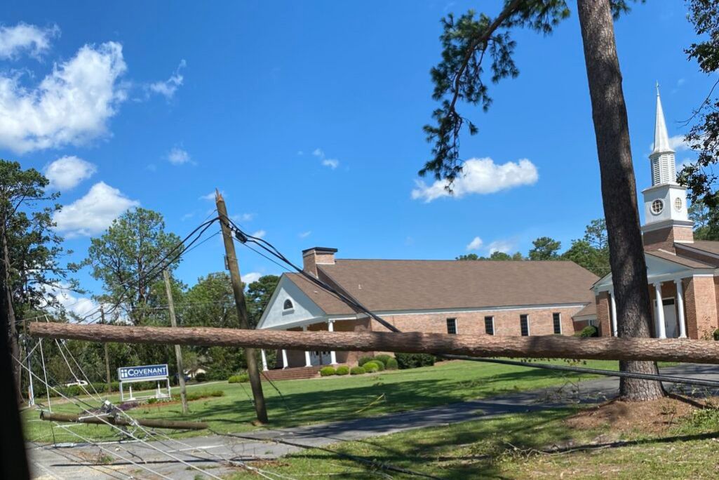
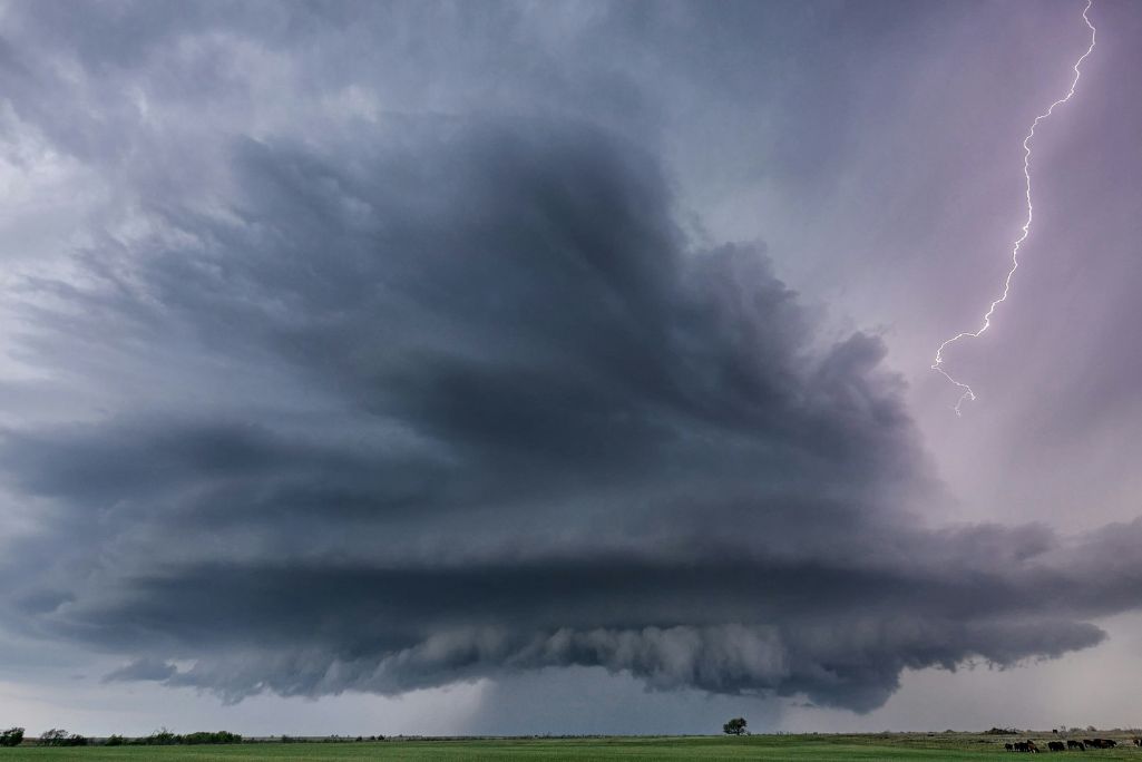
Severe weather is likely over the Lower/Mid-Missouri/Mississippi valleys and Lower Ohio Valley late Friday afternoon into Saturday, the National Weather Service (NWS) reported today. The possibility exists of strong tornadoes alongside widespread wind gusts reaching 90 mph and the possibility of baseball-sized hail.
The outbreak will continue Saturday overnight into Sunday from the central Gulf coast states and Deep South into the Ohio Valley and include “significant” tornadoes, damaging winds and hail.
Mississippi State Director Hubert Yates said long-range forecasts are monitored. However, as the weather picture becomes clearer, Disaster Relief (DR) team leaders conduct final equipment checks and assess the number of available volunteers on alert status based on storm expectations in their area.
“It’s primarily about readiness and availability,” Yates said.
Missouri Baptist Disaster Relief State Director Gaylon Moss said he is staying in communication with state convention leadership and monitoring forecasts.
“We recommend people and churches have a way to get local severe weather alerts and know where to go in their home, business or facility to be protected,” he said. “And if possible, help your neighbors if damage occurs.”
Moss added that most weather apps such as AccuWeather or The Weather Channel are adequate as long as they use National Weather Service alerts.
“Be sure notifications are turned on in your phone as well,” he said.
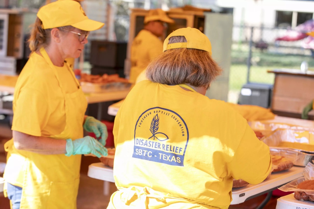
State leaders Baptist Press (BP) spoke with, as well as Coy Webb, Send Relief’s Crisis Response director, a role which includes Disaster Relief, encouraged the monitoring of weather reports and preparation.
Stan Statham, Louisiana state director, uses various apps like one produced by the American Red Cross for emergencies.
“There are three things to do,” he said. “First, make a plan (a walk-through feature on the Red Cross app) on where you’re going to go in your home or at work if bad weather arrives. Second, make a kit that includes basic supplies like flashlights, first aid and food and water. Third, stay informed by downloading weather apps. Pay specific attention to those provided by local news stations and other media.”
It wouldn’t be a bad idea to have important documents saved in the kit or on a flash drive, he added.
“Stay informed and keep an eye on the weather,” Statham said. “Prepare for the worst but hope for the best.”
Leaders and DR teams will maintain contact as the expected storms move through.
“We monitor the NWS, Mississippi Emergency Management and local first responders tracking damage reports and requests for assistance,” said Yates.
Those partners work alongside the church, the association and the DR networks to identify areas needing assistance and begin the response process.
“That helps us assess the scope and level of our response,” Yates said. “If we move to standby status, that indicates to our volunteers that a response is in the works but assessments need to be completed, hosting sites established and support arranged prior to deploying.”
He encourages resources to his volunteers and leaders such as ready.gov and the Mississippi Emergency Management Agency.
“When faced with an anticipated event, take steps to reduce the danger and mitigate hazards,” he said. “Pick up. Tie down. Protect. Fuel up.”
(EDITOR’S NOTE — Scott Barkley is chief national correspondent for Baptist Press.)